
Grand Teton National Park
In August 2017, I travelled to the United States for the first time for a trip to the Grand Teton and Yellowstone National Parks, which was timed to coincide with a total solar eclipse. The point of entry was Salt Lake City from where we would connect to Jackson Hole. It has to be said that my arrival was the most ignominious I have made anywhere!
I have suffered from travel sickness since childhood, but had always found air travel didn’t affect me. However, on landing at Salt Lake City, I felt absolutely dreadful and ended up vomiting violently into a pillowcase of a sick bag provided by the air hostess. By the time I was able to walk the length of the plane to disembark, we were well behind our fellow passengers. Luckily, I was travelling with friends, Gordon and Adele, who carried my hand luggage; I couldn’t have done it without them. On leaving the plane, the ground seemed to buck beneath me. I can only describe it as trying to walk across a giant bouncy castle. I just couldn’t do it … and the clock was ticking to collect our luggage, get through immigration and onto our connecting flight. So I was put in a wheelchair. Oh the indignity! My, by now long-suffering friends, pushed me as fast as possible to get our luggage, three lonely bags going round and round on the carousel. Even in my almost catatonic state, I had to help with the luggage as they didn’t have enough hands. So picture, if you will, me sat in a wheelchair with my head in another large sick bag between my knees dragging a bag in each hand. Thank goodness for bags with wheels! The only silver-lining to my farcical state was we got bumped to the head of the queue in immigration - I have a vague recollection of having to lift my head to be photographed (I dread to think what that photo looked like!), and proffering my hands when prompted for fingerprints. Needless to say, we were the last to board the connecting flight, but we made it. My landing wasn’t much better in Jackson Hole, but I did at least manage to walk off the plane and into the airport whereupon I was parked on a seat with a bottle of water and left to my own devices for a while. Gordon hasn’t flown with me since!


Having never been to the USA before, I don’t think I could have chosen a better introduction to the country. The scenery in the Grand Teton National Park is breathtaking. The park is located in northwest Wyoming, sort of mid-west America, and, extending to about 480 sq miles, includes the 40 mile long Teton Range. It is named for Grand Teton, the tallest mountain in the range. The naming of the mountains is attributed to early 19th-century French-speaking trappers—les trois tétons (the three teats) was later anglicised and shortened to Tetons.
The region has been inhabited for at least 11,000 years starting with the hunter-gatherer Paleo-Indians who migrated into the region during warmer months seeking food etc. In the early 1800s, the first white explorers encountered the eastern Shoshone natives as the region attracted fur trading companies that vied for control of the lucrative beaver pelt trade. The first permanent white settlers arrived in Jackson Hole, where we were based, in the 1880s.
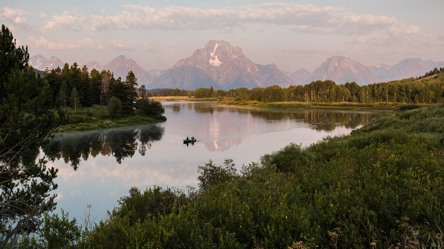
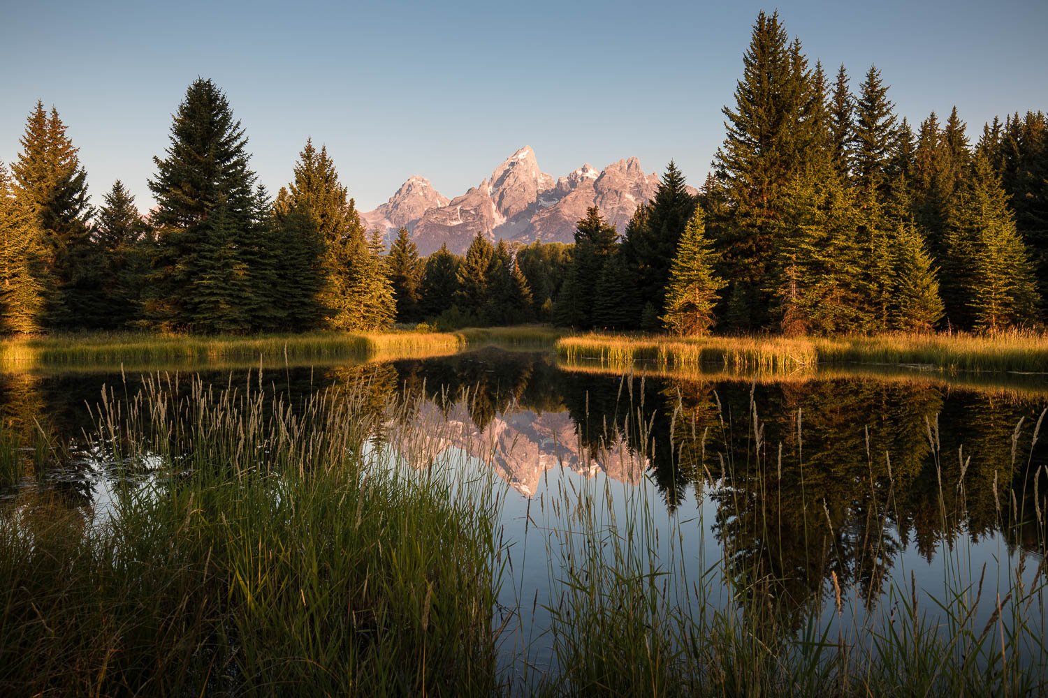
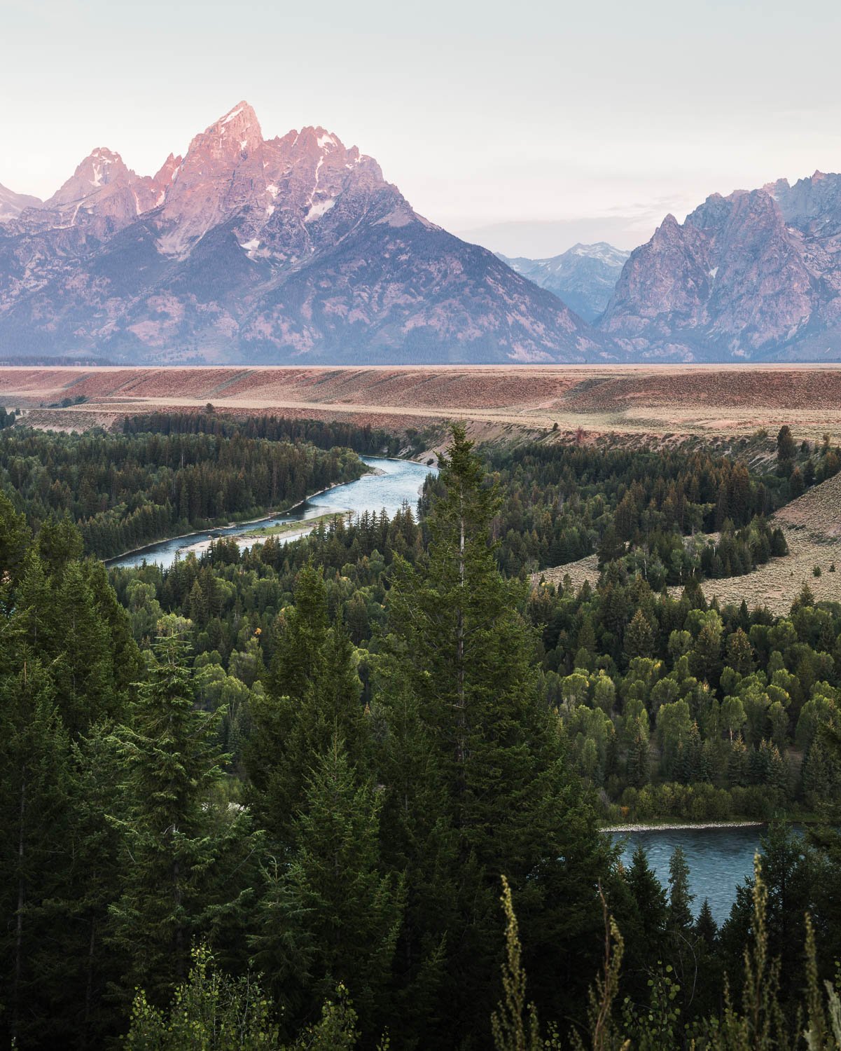
Our first full day in Jackson Hole saw us heading out to Oxbow Bend for a sunrise shot. It must be the most photographed place in the entire park. We weren’t alone in trying for the shot; we were pretty much standing elbow to elbow with other photographers. The image of the wide, shallow horseshoe-shaped curve in Snake River with Mount Moran’s reflection is iconic. It wasn’t the best of sunrises but we had the bonus of a couple in an open canoe paddling into the shot at just the right moment.
Incidentally, the name Snake River was derived from an S-shaped gesture the Shoshone tribe made with their hands to represent swimming salmon. Explorers misinterpreted it to represent a snake, giving the river its present-day name (it’s had several).
One of the aims of the trip was to photograph the total solar eclipse. Getting any shot, for the most part, doesn’t just involve just rocking up and hoping for the best. Of course there are never any guarantees in photography, but to give yourself the best chance you have to plan and check out your locations etc. To this end, we visited our intended location at the Mormon Barns the day before the eclipse, not so much to look at compositions (we were going to be pointing our cameras at the sun, after all) but to test out our equipment. And it is just as well. A couple of us had 13 stop neutral density filters that we were going to use, but discovered that we couldn’t focus the lens through the filter. Normally this isn’t a problem; you would focus and then put the filter in place. But that wasn’t going to be possible when it was the sun we needed to focus on. So that plan was scrapped. Luckily, Marcus, one of the trip leaders, had some spare solar film with him and, once we got back to the accommodation, made some filters from the film and cardboard that were then taped onto our lens hoods. It was all very Blue Peter, but they worked!
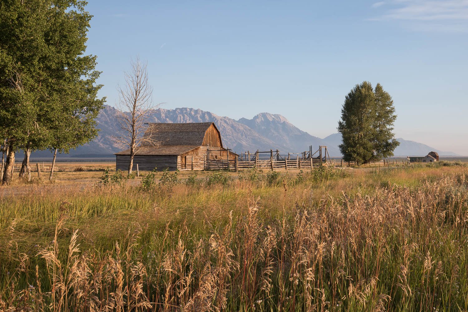
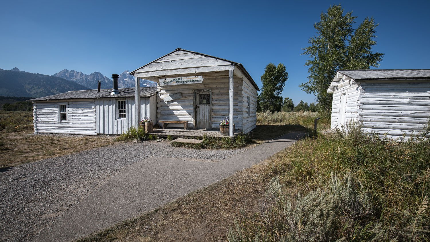
While at the Mormon Barns, we took the opportunity to have a look round. The barns are on Mormon Row, a district consisting of a line of homestead complexes along the Jackson-Moran Road between the towns of Moose and Kelly. It’s also known as Antelope Flats. The Mormon homesteaders began to arrive in the 1890s from Idaho, creating a community called "Gros Ventre" with a total of 27 homesteads lined up along a central road. The fields and agricultural lands were located behind each of the homesteads. These Mormon “line villages” were also popularly known as “Mormon Rows” throughout the west. The nickname directly referred to the spatial organisation of the villages, as well as the dominant religion they practiced. These small communities were built upon communal cooperation, sharing resources and workloads. Such cooperative land practices were based directly out of the Book of Mormon, which also described the types of houses the faithful should live in.
It is now a rural historic landscape with a period of significance which includes the construction of the Thomas Murphy, T. A. Moulton and John Moulton farms from 1908 to the 1950s. Six building clusters and a separate ruin illustrate Mormon settlement in the area with features such as drainage systems, barns, fields and corrals.
Click on the images to see them full-size - all John Moulton’s homestead apart from the last two, which are Thomas Murphy’s homestead just to the north.


The majority of the buildings that we saw belonged to John Moulton who arrived in Jackson Hole with his brother, Thomas Alma, in 1907. They filed for adjacent claims and began work to clear 80 acres of land, construct a cabin, barn, corrals and related fencing. John was well known in the valley for his dairy business, and lived to be 103 years old; he is largely remembered, however for the ‘pink house’ he built. We saw the ‘pink house’ (above) and did wonder about its colour. Apparently, while John’s wife, Bartha, was in hospital, John wanted to do something special to commemorate her homecoming. He knew that she had wanted to repaint the house, and due to a small mix-up, chose the salmon pink colour. When Bartha came home, she despised the colour, but so loved the sentiment behind it that it was never changed.
Eclipse day saw us setting off early the next morning to claim our spots for the event. The radio was warning of busy roads etc. but we didn’t encounter any problems other than it being slightly harder to find parking than the day before. Needless to say, there were other photographers about, but not as many as I had thought may be there. There was plenty of time to get some early morning shots of John Moulton’s barn, which involved wading through the abundant big leaf sagebrush.


We then moved to a spot where we could all set up together for the eclipse. Normally this isn’t the best case scenario as you don’t want to get the same shot as everyone else, but on this occasion there was a sensible reason besides the fact the shots would look the same wherever we stood. Only Marcus had shot an eclipse before, and there were a few key stages of the eclipse which we were aiming to capture. Some of these would only last a second or two, so he couldn’t possibly assist everyone during this time. If we were all grouped together (within ear shot), he could call out instructions; synchronised shooting! Needless to say, there was a fair amount of faffing about as we all got ourselves sorted out - just as well we got there early!

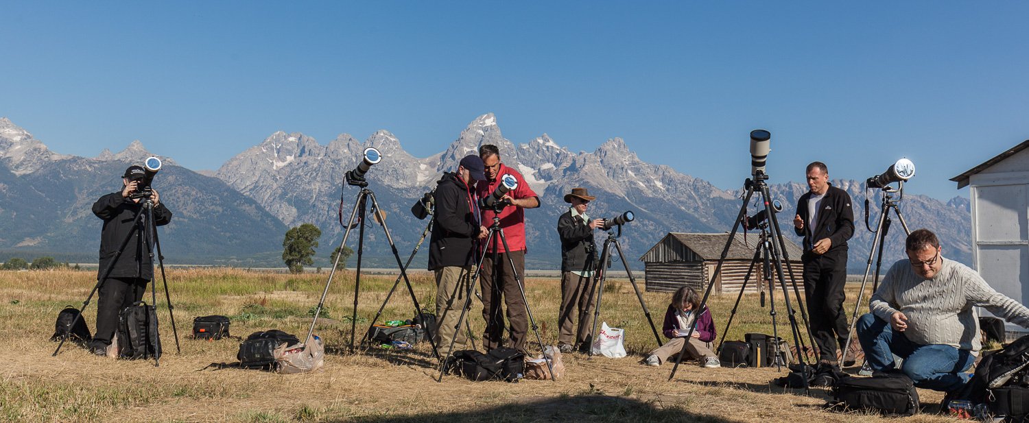
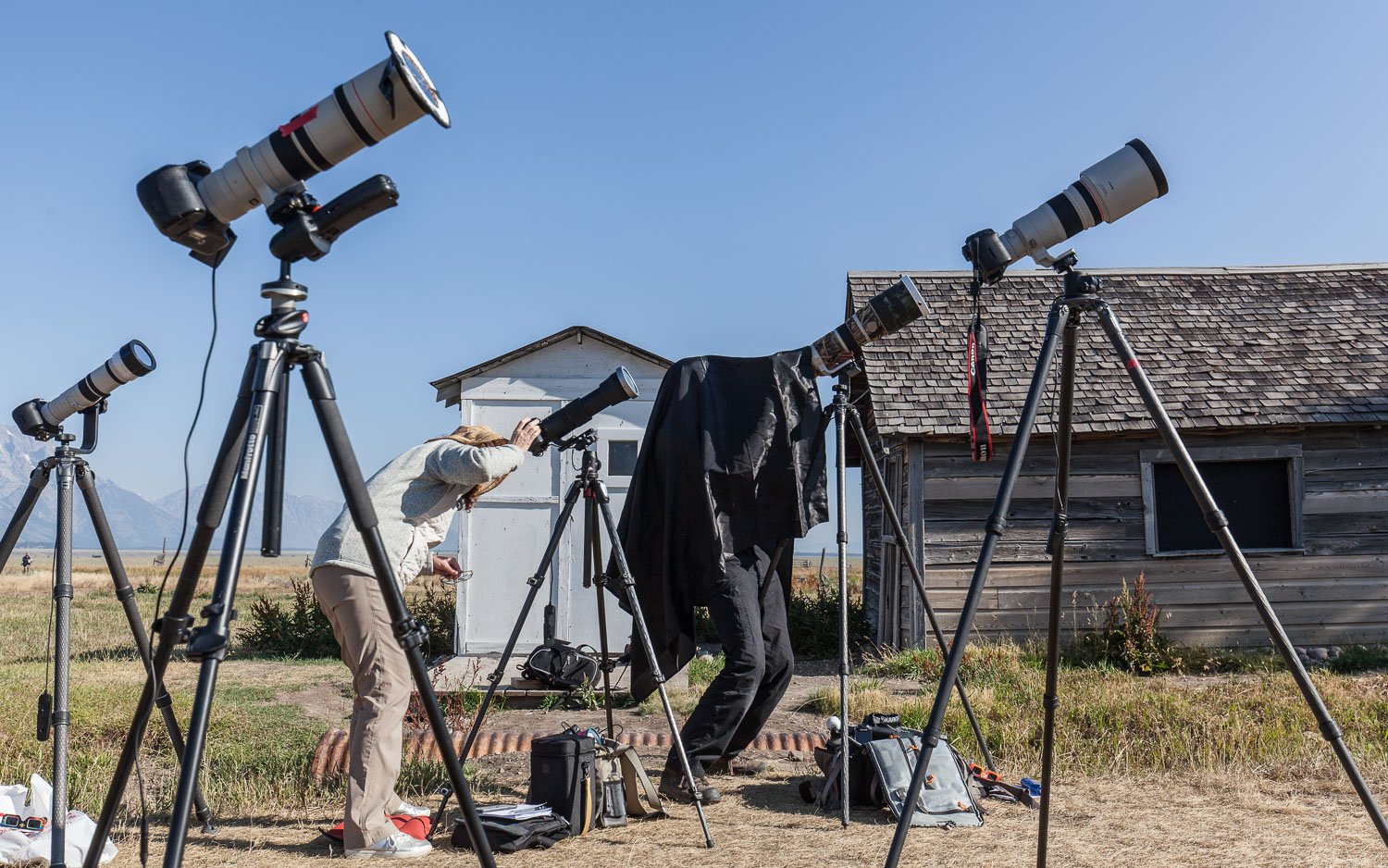
As we waited for the main event of the day, there was almost a party atmosphere. Small groups of people were spread out around us, many of them extended families complete with large picnics and fizzy stuff. It became apparent after a while that we were attracting quite a bit of attention ~ I suppose we did look a bit odd all lined up with cameras, long lenses and strange contraptions on the end of them ~ some folks eventually plucked up the courage to come and ask where we were from and what we were up to.
So, what were we there to photograph? There are 5 stages in a total solar eclipse:
Partial eclipse begins (1st contact): The moon starts becoming visible over the sun's disk. The sun looks as if a bite has been taken from it.
Total eclipse begins (2nd contact): The entire disk of the sun is covered by the moon. Observers in the path of the moon's umbra (the dark core of the moon’s shadow) may be able to see Bailey's beads and the diamond ring effect, just before totality. Bailey’s beads are little bead-like blobs of light at the edge of the moon. They are created because gaps in the mountains and valleys on the moon's surface allow sunlight to pass through in some places but not others.
Totality and maximum eclipse: The moon completely covers the disk of the sun. Only the sun's corona is visible. The corona is the outermost layer of the sun’s atmosphere, and it is around 200–300 times hotter than the sun’s surface. This is the most dramatic stage of a total solar eclipse. At this time, the sky goes dark, temperatures can fall (they did), and birds and animals often go quiet. The midpoint of time of totality is known as the maximum point of the eclipse. Observers in the path of the Moon's umbra may be able to see Bailey's beads and the diamond ring effect, just after totality ends.
Total eclipse ends (3rd contact): The moon starts moving away, and the sun reappears.
Partial eclipse ends (4th contact): The moon stops overlapping the sun's disk. The eclipse ends at this stage in this location.
It was a truly wonderful event to witness ~ it took almost three hours from the first to last contact. Once it was over and everyone had had a chance to check the back of the camera and see that they had got what they wanted, there was a palpable sense of relief. It was almost as if the trip could now begin properly.


Next morning saw us heading out exceptionally early for a sunrise shoot at Schwabacher Landing; so early, in fact, that we picked our way down a narrow trail path to the optimum location by torchlight. It is a spot on Snake River, almost exactly east of Grand Teton, where the terrain flattens out and allows easy access to the river and is a spectacular viewpoint popular with photographers. The early start was to ensure that, as we were a relatively large group, we all got a spot for the best composition. The tactic paid off as we were the first to arrive. It didn’t take too long before we were joined by other photographers. One chap had even brought a step ladder with him, which he erected immediately behind me (so much for personal space); if I had forgotten about him and stepped back, he’d have been knocked off.
I’ve had a trawl through the internet and there is almost no history regarding who Schwabacher was, what he was doing there and why the ‘landing’ was named after him. I have found one account, although unsubstantiated. The source suggests this took place in the 1920s. Apparently, Schwabacher was a man of dubious qualities. ‘He was a heavy drinker, he smoked cigars in the presence of ladies, he would spit in the river whenever he felt like it whether he was upstream from camp or not, he used rude language, he was unkind to animals and small children, and he didn’t attend church unless there was that service where they give wine to the faithful and then he left right after the wine was served.
His personal hygiene would become the topic of conversation whenever he was near other people, and the general consensus was that he didn’t have any. When you put him on a small boat with several other less than fastidious people, the fact that it would be mentioned at all indicates that he probably stank. Mr. Schwabacher’s smelly presence must have had a prodigious effect. So much so that they landed their boat and unceremoniously threw him onto the shore to save themselves, being sorely afraid that they would otherwise all be overcome and die. Hence the name Schwabacher’s Landing.
History does not relate what Mr. Schwabacher’s fate was. It was rumoured that he could walk anywhere in this country in perfect safety because even the grizzlies wouldn’t eat him and grizzlies will eat anything.’
Believe it if you will….


We had a little explore of some of the creeks that fed into Snake River. Great fun, although you always have to be aware that there may be bears about. Snake River is used for rafting and the one above passed us. If you zoom in on the raft you can see it says ‘Solitude Float Trips’. Really? Not much solitude to be had jammed into a raft like sardines!
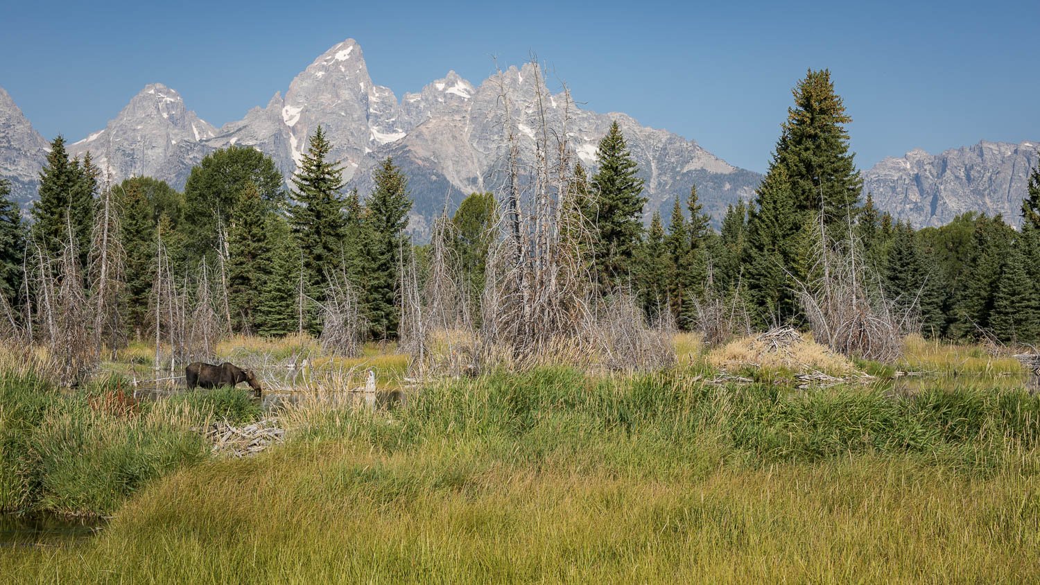
Heading back to Schwabacher Landing, we were delighted to see a moose in Beaver Pond. If I’m honest, it wasn’t the best example of the species as it had a funny eye, but you have to take what you get!


Next on the list for the day was Menor's Ferry, which once belonged to William D. Menor. He came to Jackson Hole in 1894, taking up a homestead beside Snake River where he constructed a ferryboat that became a vital crossing for the early settlers of Jackson Hole Valley.
Jackson Hole was isolated by its surrounding mountains and had such a harsh climate that it was one of the last areas of the lower 48 states to be settled. Homesteaders came here, mainly from Idaho, beginning in the late 1880s. Most early settlement in the valley took place in the south, or on a few scattered areas with fertile soil on the east side of the Snake River. Menor was alone on the west side of Snake River for more than ten years.
Rivers are often important transportation corridors. However, Snake River was a natural barrier that divided the valley. In dry months, the river could be forded safely in several locations, but during periods of high water even the most reliable fords were impassable. After 1894, Menor’s Ferry became the main crossing in the central part of Jackson Hole. Residents crossed on the ferry to hunt, gather berries and mushrooms, and cut timber at the foot of the mountains.
Bill Menor built the original ferryboat and cableworks. The ferry and cableworks there today are replicas. Menor charged 50c for a wagon and team and 25c for a rider and horse. Pedestrians rode free if a wagon was crossing. When the water was too low for the ferry, Menor suspended a platform from the cable and three to four passengers could ride a primitive cablecar across the river. In later years, Menor and his neighbours built a bridge for winter use, dismantling it each spring.
The cabin at the site was built in 1916, originally on the east side of Cottonwood Creek by Harry Clissold for Maud Noble. She had first come to Jackson Hole in 1915, staying at the Bar BC as a dude for the summer. She came from a wealthy family in Philadelphia and was believed to have been 45 to 50 years old when she first arrived to the valley. Like so many before and after her, she decided to stay and reside permanently in the valley. This small three-room home was the ideal size for a single woman. In 1918 Maud had Clissold move the cabin to its current location just south of the buildings at Menor’s Ferry in Moose. The three rooms were converted to serve as two bedrooms and a central living area. The kitchen was removed from the house because Maud took all her meals up at Bill Menor’s house. In this same year she purchased the ferry from Menor and took over operations. She raised the ferry prices to $1.00 for Wyoming residents and $2.00 for anyone else.
Maud lived in this house with a man named Sydney Frederick Sandell. He occupied the second bedroom that was converted from a kitchen. Their partnership was a source of gossip throughout the valley - you can imagine! Maud never did anything to confirm or deny a relationship with Sandell and their story remains a mystery today. Sandell was believed to have a wife ‘back home’. It was impolite to discuss single men and woman residing in the same home together so Sandell is often left out of Maud’s story. Maud and Frederick continued to live together, however, even after Maud sold the property to the Snake River Land Company in 1929. They purchased a second ranch near Wilson where their living arrangements there are unknown. They both parted ways in 1943 when Maud returned home to Philadelphia to be with family.


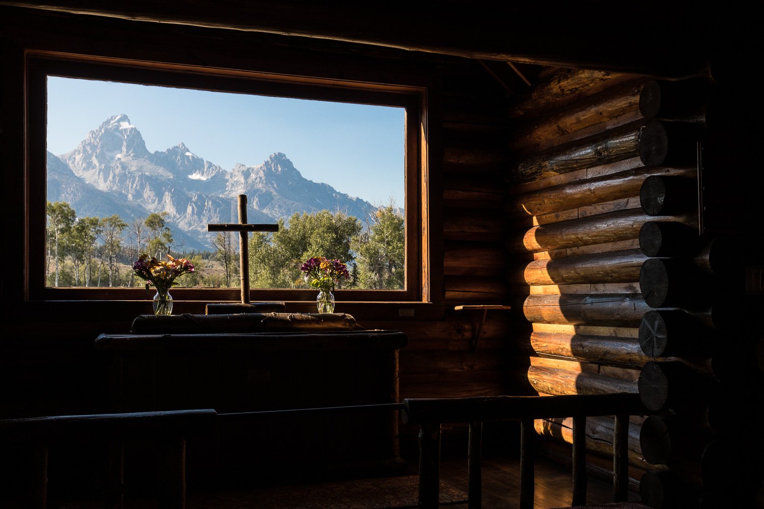
Close by is the Chapel of the Transfiguration, which is a small log chapel. Built in 1925, it was sited and built to frame a view of the Cathedral Group of peaks in the large window behind the altar.
The chapel was built to serve guests and employees of the dude ranches that stretched north of Jackson along the base of the Teton Range. The land was donated by Maud Noble, owner of nearby Menor's Ferry, predating the establishment of Grand Teton National Park in 1929 and its expansion into the Moose area in 1950.


Whilst researching all of the above, the phrase ‘dude ranch’ cropped up a few times and it piqued my curiosity - surely they weren’t farming dudes! The correct title is ‘guest ranch’, which is a type of ranch geared towards visitors and is considered a form of agritourism.
Guest ranches arose in response to the romanticisation of the American West that began to occur in the late 19th century, much like the romanticisation of Scotland in the Victorian era. In 1893, historian Frederick Jackson Turner stated that the United States frontier was demographically ‘closed’. This in turn led many people to have feelings of nostalgia for bygone days, but also, given that the risks of a true frontier were gone, allowed for nostalgia to be indulged in relative safety. Thus, the person referred to as a ‘tenderfoot or a ‘greenhorn’ by westerners was finally able to visit and enjoy the advantages of western life for a short period of time without needing to risk life and limb.
The western adventures of famous figures, like Theodore Roosevelt, were made available to paying guests from cities of the East, called ‘dudes’ in the West. In the early years, the transcontinental railroad network brought paying visitors to a local depot, where a wagon or buggy would be waiting to transport people to a ranch. Experiences varied. Some guest ranch visitors expected a somewhat edited and more luxurious version of the ‘cowboy life’, while others were more tolerant of the odours and timetable of a working ranch. While there were guest ranches prior to the 20th century, the trend grew considerably after the end of World War I, when postwar prosperity, the invention of the car and the appearance of Western movies all increased popular interest in the west. In 1926 the Dude Ranchers Association was founded in Cody, Wyoming, to represent the needs of this rapidly growing industry.
We’ve all heard, and probably used the word ‘dude’, but where did it come from? From the 1870s to the 1960s, it primarily meant a person who dressed in an extremely fashionable manner (a dandy) or a conspicuous citified person who was visiting a rural location, a ‘city slicker’ (like in the movie). In the 1960s, dude evolved to mean any male person, a meaning that slipped into mainstream American slang in the 1970s. Current slang retains at least some use of all three of these common meanings.
The implication of an individual who is unfamiliar with the demands of life outside of urban settings gave rise to the definition of dude as a ‘city slicker’, or ‘an Easterner in the [United States] West’. Thus ‘dude’ was used to describe the wealthy men of the expansion of the United States during the 19th century by ranch-and-homestead-bound settlers of the American Old West. This use is reflected in the dude ranch. This usage of ‘dude’ was still in use in the 1950s in America, as a word for a tourist—of either gender—who attempted to dress like the local culture but failed. An inverse of these uses of ‘dude’ would be the term ‘redneck’, a contemporary American colloquialism referring to poor farmers and uneducated persons, which itself became pejorative, and is also still in use.
But I digress…
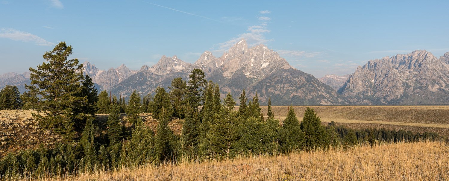
No visit to the Grand Teton National Park would be complete without stopping at Snake River Overlook, a viewpoint made famous by Ansel Adams, a landscape photographer and environmentalist known for his black and white images of the American West. This was the location for our last morning in the park and below is my take on the iconic view. You can see how much the trees have grown since 1942.

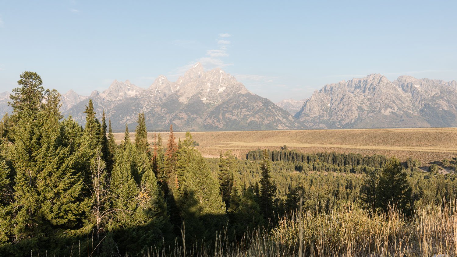
Once ‘the’ shot had been taken, I wandered off along a path so see what other views were to be had.


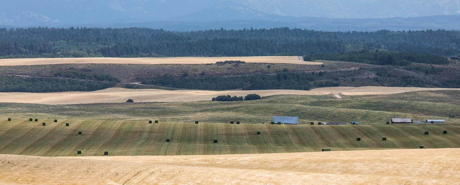
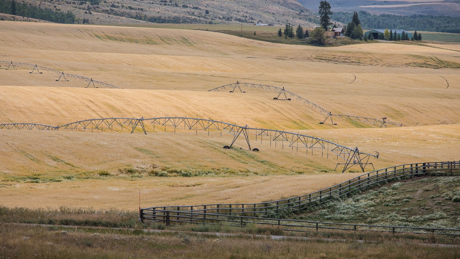
Grand Teton National Park is only 10 miles south of Yellowstone National Park, our destination for the second part of the trip. However, our base was to be West Yellowstone, which is actually outside the park, so, rather than drive up through the park, we headed off through Idaho. This meant that we got to see a yet another landscape. Apparently the state is best known for its potatoes, but we didn’t see any agriculture other than vast tracts of cereal fields.


One last stop before reaching West Yellowstone was Bitch Creek. A bit of an odd name and it was much debated in the group, but it is said to be a corruption of the French word "biche" (which means doe), and that French trappers originally named the waterway "Anse de Biche.”


And so we arrived at West Yellowstone. But that’s another story for another day…..